South American Historical Map for SAMA
Original map for San Antonio Museum of Art - catalog and exhibit use.
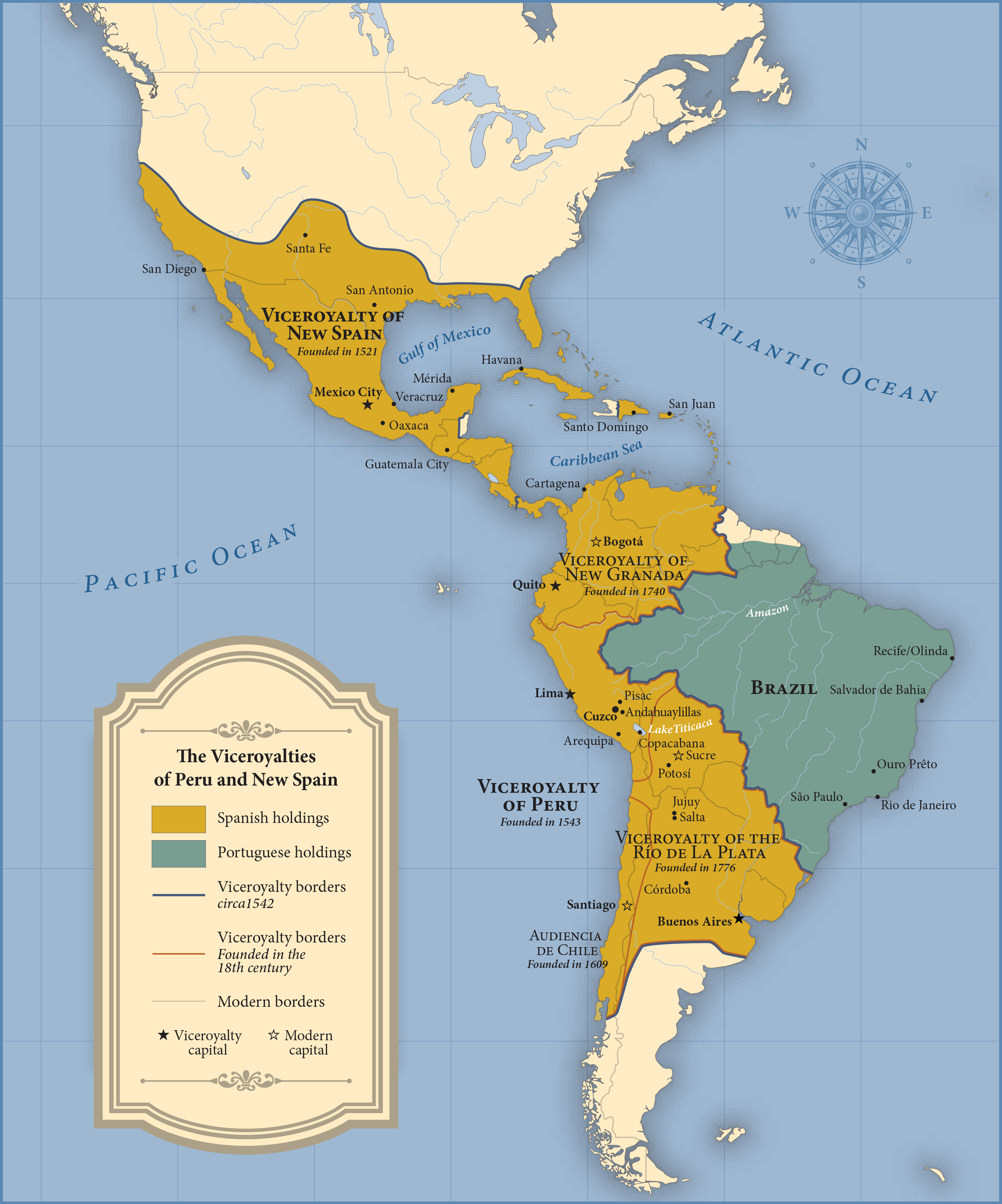
Original map showing areas of Central and South America controlled by Spain and Portugal in the 17th and 18th centuries. The map supports curatorial work behind a new exhibit of Viceregal art and objects to be mounted in Spring 2016.